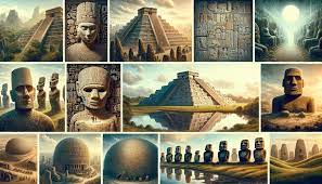
Civilizations
The allure of lost civilizations like Atlantis and the Mayans has fueled humanity’s quest for centuries, akin to a real-life treasure hunt. In this essay, we delve into how geography serves as the guiding compass in uncovering these hidden gems. Through the lens of remote sensing, GIS technology, and traditional archaeological methods, we unravel the mysteries of the past.
Remote Sensing:
Picture satellites as powerful spy gadgets, piercing through dense forests to reveal buried treasures beneath the earth’s surface. Remote sensing utilizes satellite images to detect anomalies like crop marks or vegetation changes, hinting at ancient structures concealed below. It’s akin to playing detective, but with the aid of space cameras guiding us through the labyrinth of time.
Case Study: Finding Machu Picchu
In 1911, Hiram Bingham stumbled upon Machu Picchu while in search of another lost city. However, it wasn’t until the advent of special satellite imagery that the true extent of Machu Picchu’s grandeur was unveiled. These images unearthed hidden buildings and roads nestled under the jungle canopy, showcasing the architectural prowess of the ancient Incas.
GIS Technology:
Geographic Information Systems (GIS) act as a digital cartographer, weaving together diverse data layers to create intricate maps of ancient cities. By amalgamating maps, historical records, and terrain data, GIS unveils a comprehensive picture of ancient civilizations. This tool elucidates how people lived, sourced water, and engaged in trade, providing a window into the past.
Case Study: Exploring Petra
Petra, the enigmatic city carved into cliffs, revealed its secrets through the application of GIS technology. Meticulously mapping every crevice and corner, scientists uncovered Petra’s intricate water system, essential for its survival in the desert. It’s akin to solving a millennia-old puzzle using a sophisticated map as the key.
Traditional Archaeological Methods:
Despite technological advancements, the essence of discovery lies in traditional methods like ground surveys and excavation. These hands-on approaches unearth relics buried in the earth, resurrecting fragments of history. Imagine stumbling upon an ancient pot or forgotten temple, breathing life into forgotten tales.
Case Study: Digging Tikal
In the heart of the Guatemalan jungle lies Tikal, a testament to the might of ancient Mayan civilization. Through meticulous excavation, archaeologists unveiled temple pyramids, palaces, and residential quarters, piecing together the narrative of a lost civilization. It’s akin to being an intrepid explorer, unearthing relics and unlocking the mysteries of bygone eras.
Conclusion:
Geography serves as the compass guiding humanity’s quest to unravel the mysteries of lost civilizations. From the depths of space to the intricate web of GIS technology and the tactile exploration of traditional methods, geographic techniques illuminate the wonders of the past. As we continue our journey of discovery, let us heed the call of exploration, for hidden treasures await those who dare to seek.
By: Krishika pandit
Write and Win: Participate in Creative writing Contest & International Essay Contest and win fabulous prizes.